


Real-time Locating System (RTLS): Design of Hardware & Software Complex
Client
A system integrator specialized in real-time location systems for various applications such as employee, asset, and machinery tracking in industrial environments.
Challenge
The project involved developing a demo hardware/software complex. Our engineers performed the following jobs:
- building system components;
- developing software for quick installation on Linux stations;
- building documentation packages to be put in the project apt repository;
- developing a lightweight web application designed to replace the existing bulky standalone desktop client,
- testing the whole set.
Solution
System components
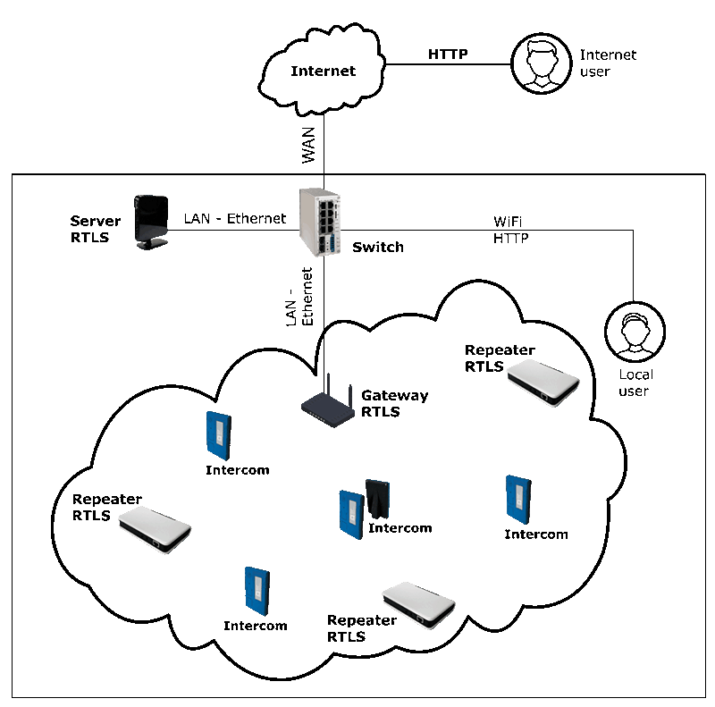
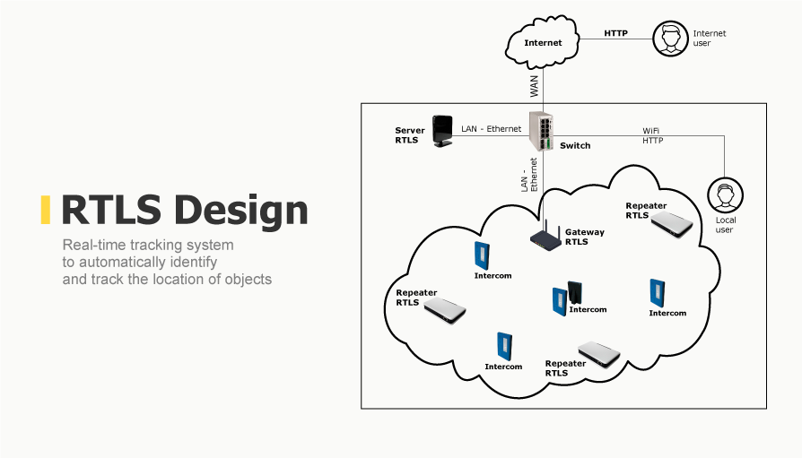
Figure 1. RTLS use chart
The radio devices of the system operated on the IEEE 802.15.4a wireless standard. The sound sent by the intercom was encoded in G729A and encapsulated into a higher-level network protocol.
The following components became parts of the system:
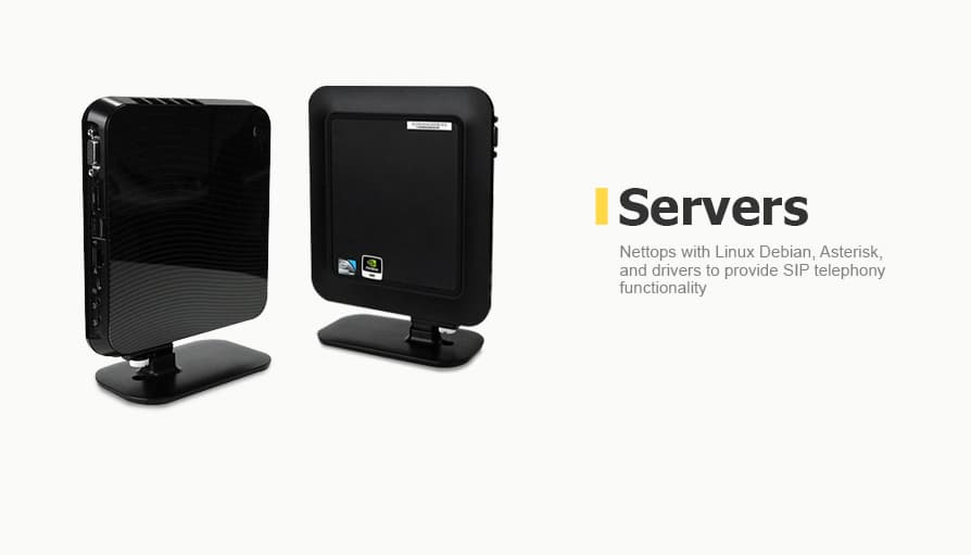
- RTLS server
The RTLS server is a nettop-type PC with installed Linux Debian, drivers, special RTLS software, as well as Asterisk software which provides SIP telephony functionality.
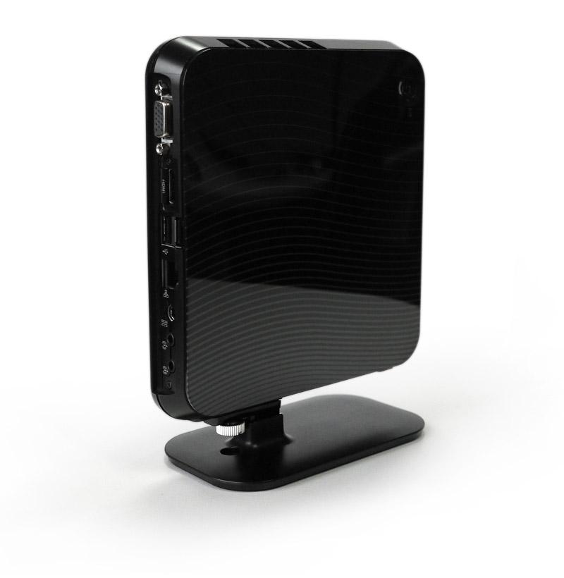
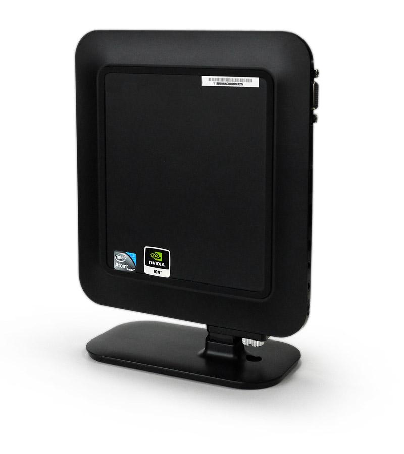
Figure 2. RTLS server
- Gateway
A gateway is an access point for data transmission between the IEEE 802.15.4a wireless network (in which repeaters and gateways interact) and the Ethernet-based wired network.
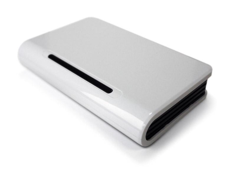
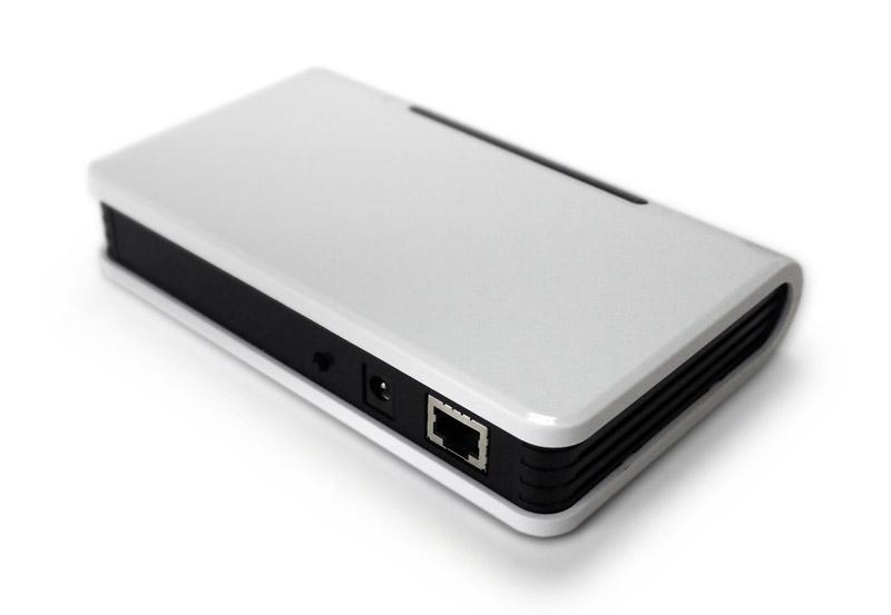 Figure 3. Access point
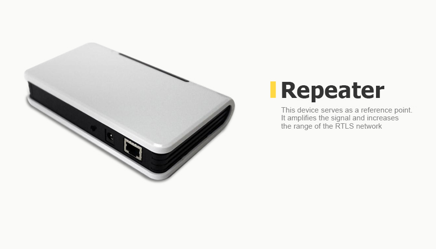
- Repeater
The repeaters are used to amplify the signal and increase the range of the RTLS network. They have a fixed position in space, and their coordinates are saved in the server software. Any access point which is not used in a gateway mode (not connected to the switch via Ethernet network) can serve as a repeater.
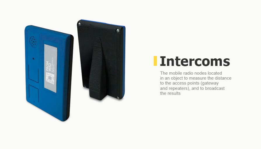
- Intercom
An intercom is a mobile radio node at a site (it’s held by a person or mounted on an object). The gateway receives the data from these intercoms and forwards them to the server for processing and pinpointing the exact location on the map to the repeaters.
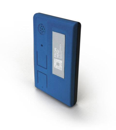
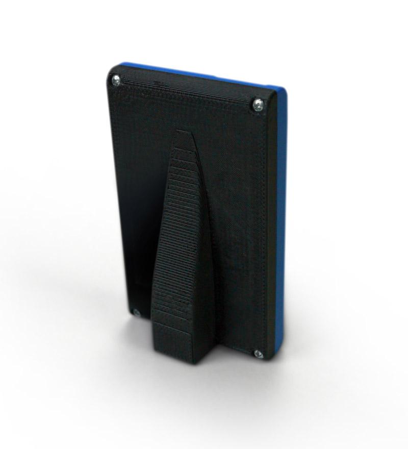
Figure 4. Intercoms
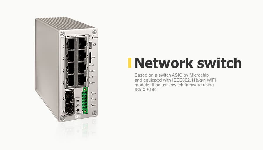
- Network switch
We used an L2 industrial network switch to communicate with the RTLS gateways and the central RTLS server. The switch is based on the Microchip switch ASIC, so we were able to adjust switch firmware using IStaX SDK. Also, it can be equipped with an IEEE802.11b/g/n WiFi module.
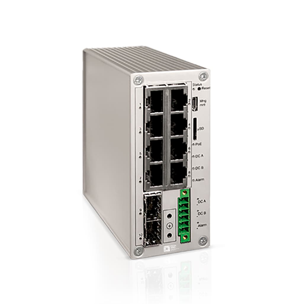
Figure 5. Industrial L2 switch
Software development
We used a script to quickly unfold the whole software package on Linux stations. The script automatically splits a drive and unpacks a pre-packaged disk image with the required software. For this purpose, booting was done from a customized live-USB flash (Ubuntu mini).
The software components:
- Ubuntu-mini remix, a trimmed Ubuntu image without a graphic environment.
- Ubuntu customization kit, a set of utilities to customize official Ubuntu images.
- An upgrader (and dumper) script is based on the dump and restores utilities which help create a compressed image of a file system for further unpacking.
The project documentation is collected automatically into a deb-package using the standard utility dpkg-build.
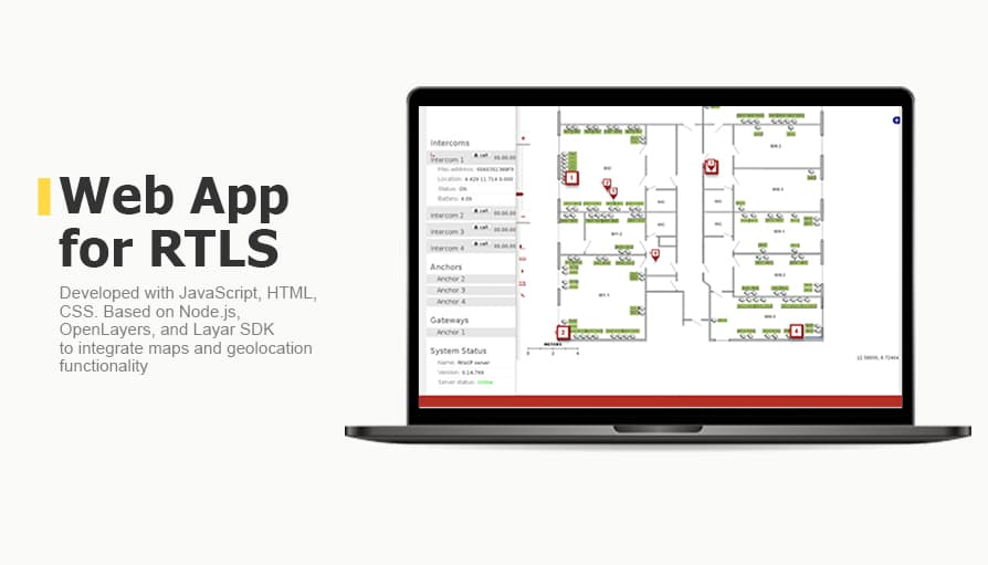
Designing a web client was a time-consuming job within this project, but it was worth it: our client ended up with a lightweight web application that is easy to manage and develop as the platform grows. It features the following functions:
- Outgoing and incoming calls to any intercom.
- Mapping the movement of the intercoms in real-time.
- Supporting a set of layers on the map: bitmap image, OSM, Google Maps.
- Recording the movement of the intercoms with the option of further displaying their trajectory.
- Placing the repeaters on the map.
- Building, displaying, and editing location graphs.
- Displaying the status of the intercoms, the repeaters, and the gateway: online/offline, battery status, signal quality, list of repeaters in sight, and the distance to each repeater (based on raw radar data).
- Measuring distances on the map using a line tool.
- Self-test function to specify certain types of the irregular initial configuration of the set.
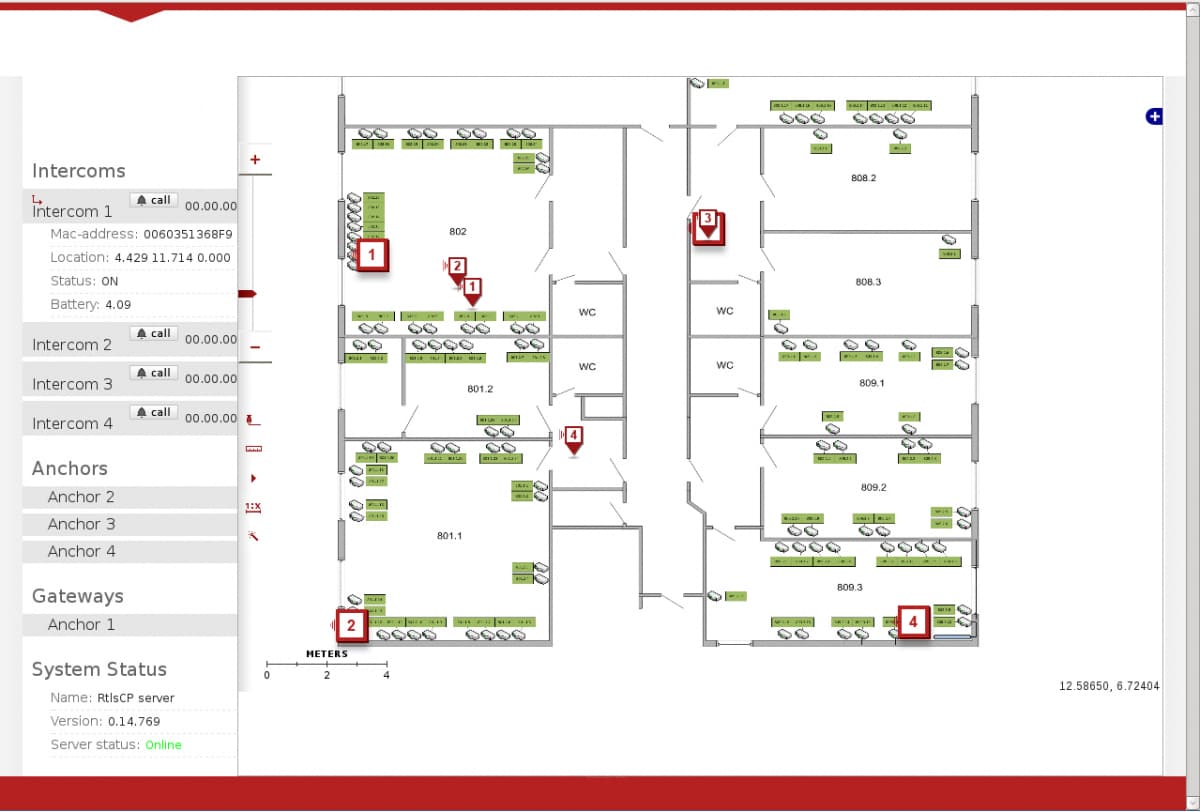
Figure 6. Web application interface
The solution was implemented in JavaScript/HTML/CSS. It is based on Node.js runtime environment, OpenLayers library, and Layar SDK to integrate maps and geolocation functionality.
Business Value
We prepared a fully functional RTLS demo environment, ready to be deployed by our customer in field trials. Also, we took care of the documentation packages to be put in the apt repository and redesigned the user interface (launched a lighter and faster web application).


